

Western Farm Trees
Reforestation by Environmental Plantings
Project overview: how is carbon sequestered?
Reforestation by environmental or mallee plantings
This method applies to projects that store carbon by establishing new forest cover through mixed-species environmental planting or the planting of mallee species.
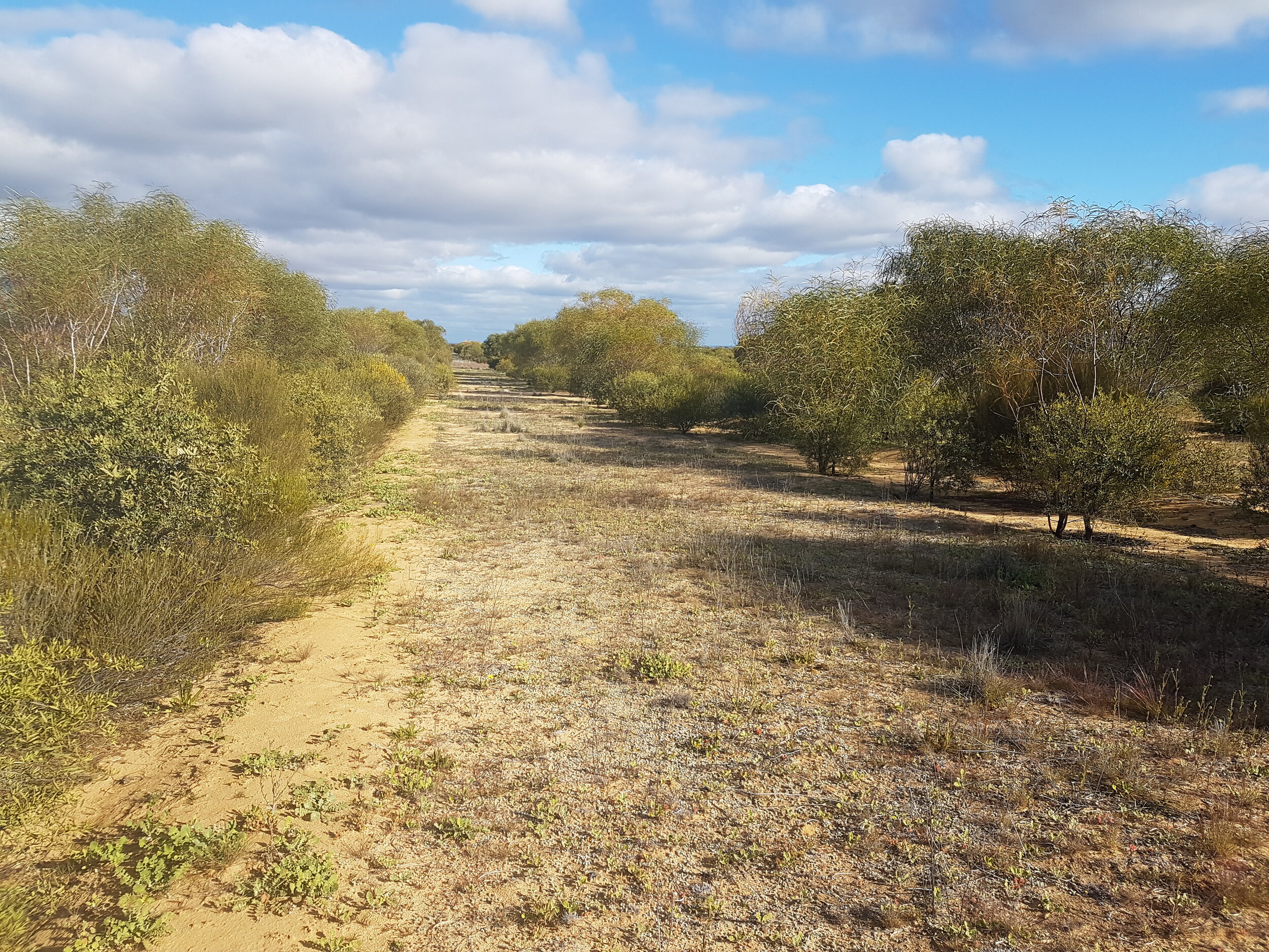
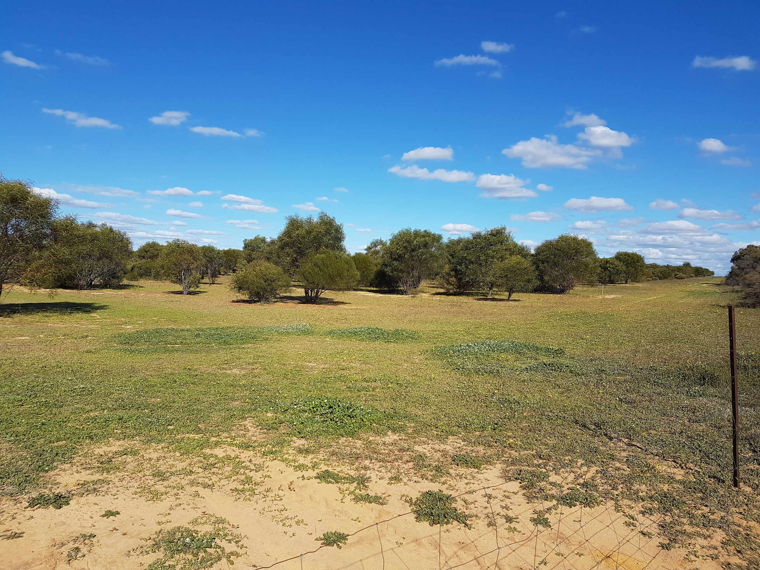
A mixed-species environmental planting must consist of a mix of trees, shrubs and understory species native to the local area. The local mixed-species or mallee species and the planting location determine how much carbon is stored.
The plantings must be permanent and not harvested.
Environmental plantings activities include:
establishing and maintaining a mixed-species environmental planting or a mallee planting
plantings must have the potential to attain a height of 2 metres and a crown cover of at least 20%
trees can be planted either as young plants or through direct seeding
trees may be grown in rows (linear belt plantings) or in groups of trees (block plantings).
For at least 5 years before the application, the project area must have been clear of forest cover.
Australian Carbon Credit Units (ACCUs) are earned when carbon is stored as a result of the project activities. The carbon store is calculated using the Full Carbon Accounting Model (FullCAM) tool.

Changed management activities on farmland
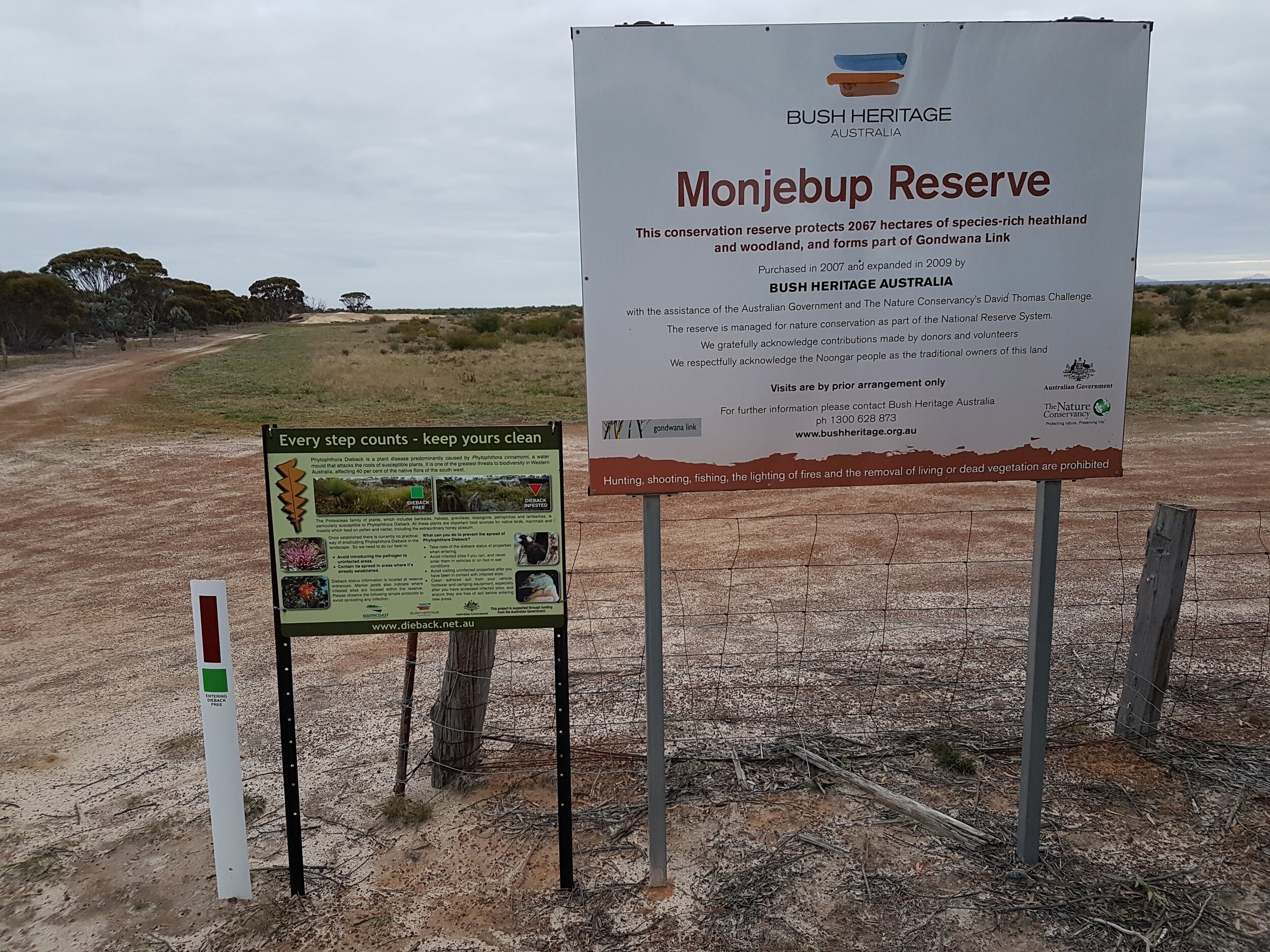
The Western Farm Trees project is an aggregation project involving six land holdings in the Western Australian wheatbelt. The project allows landowners carrying out worthy reforestation work to benefit from carbon markets.
The management actions on property involve:
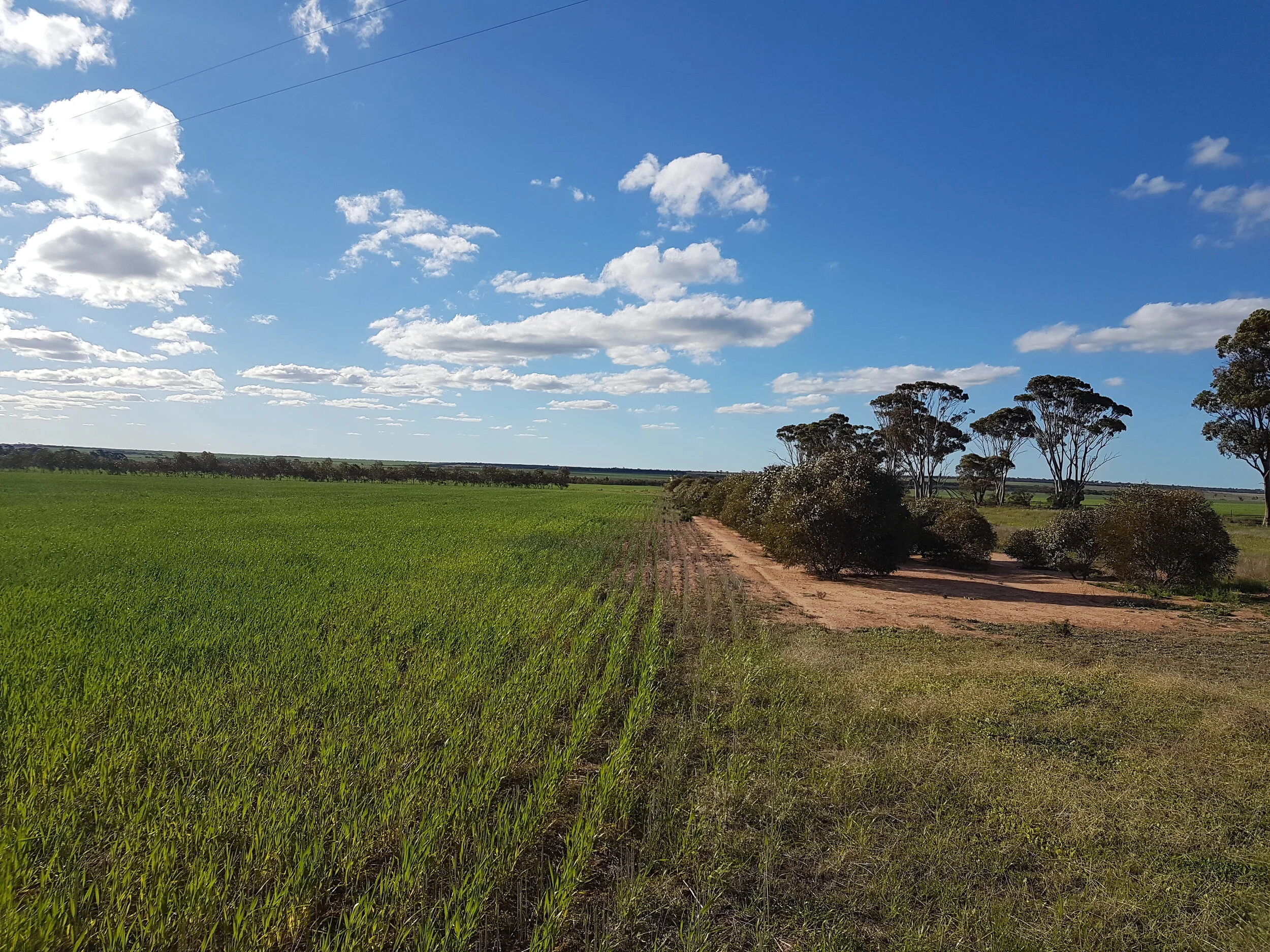
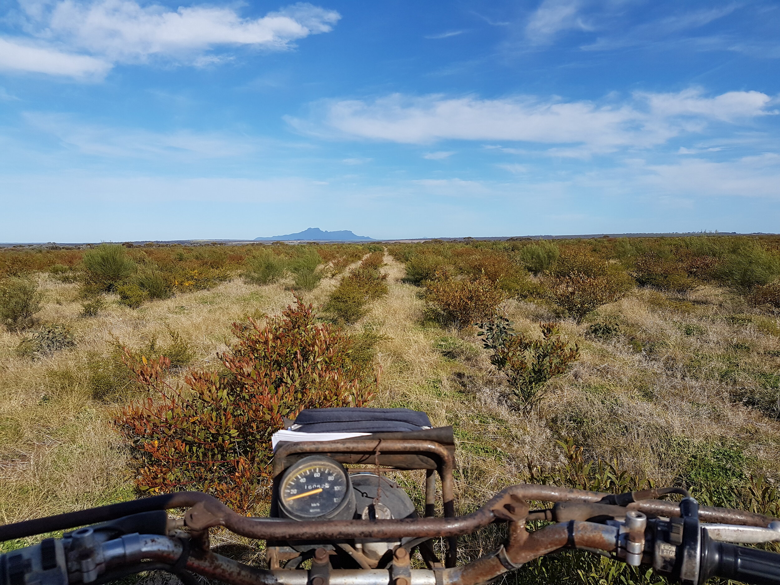
strategic planting of native vegetation into land that had, in previous years, been cleared for agricultural purposes.
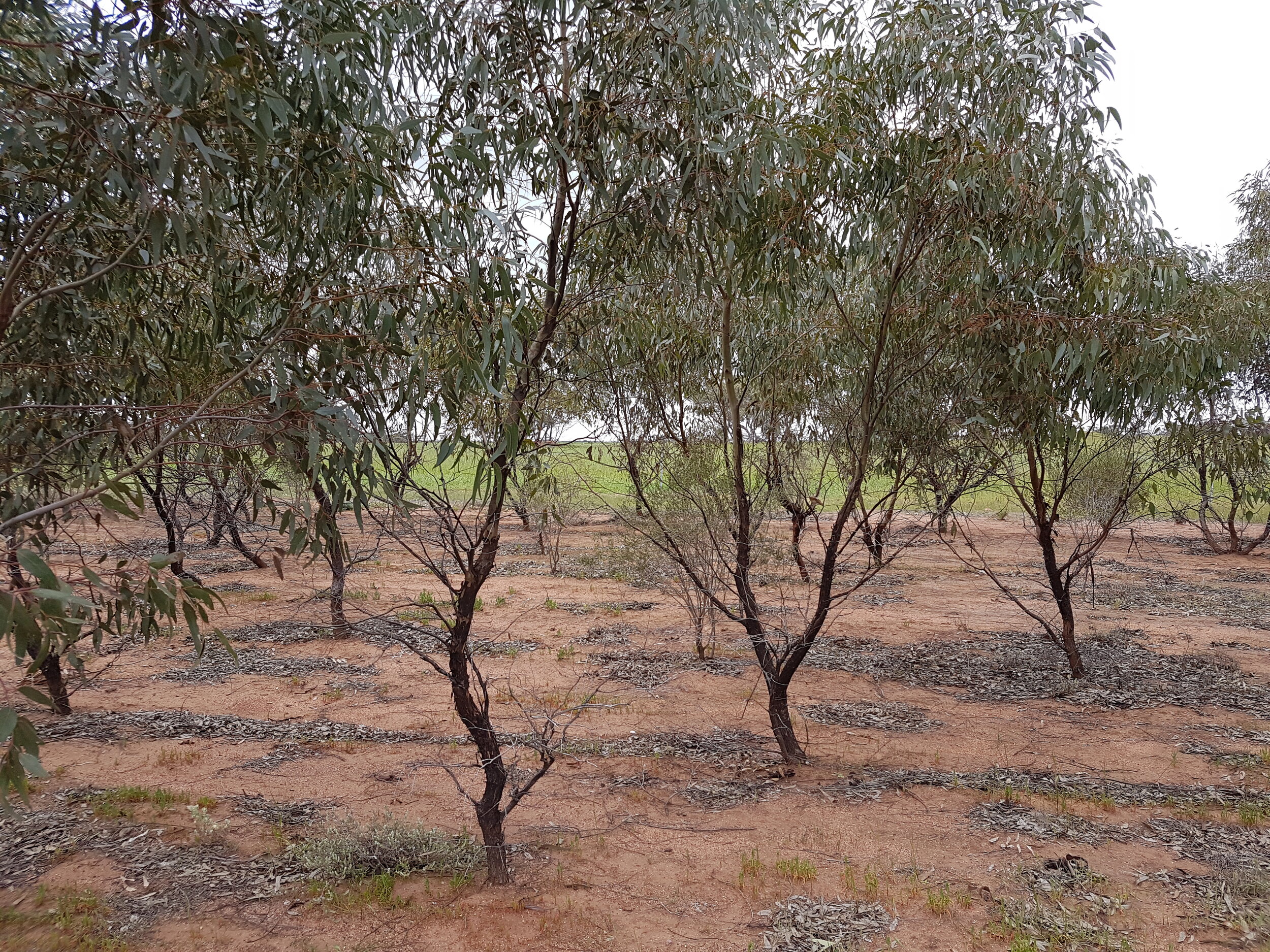
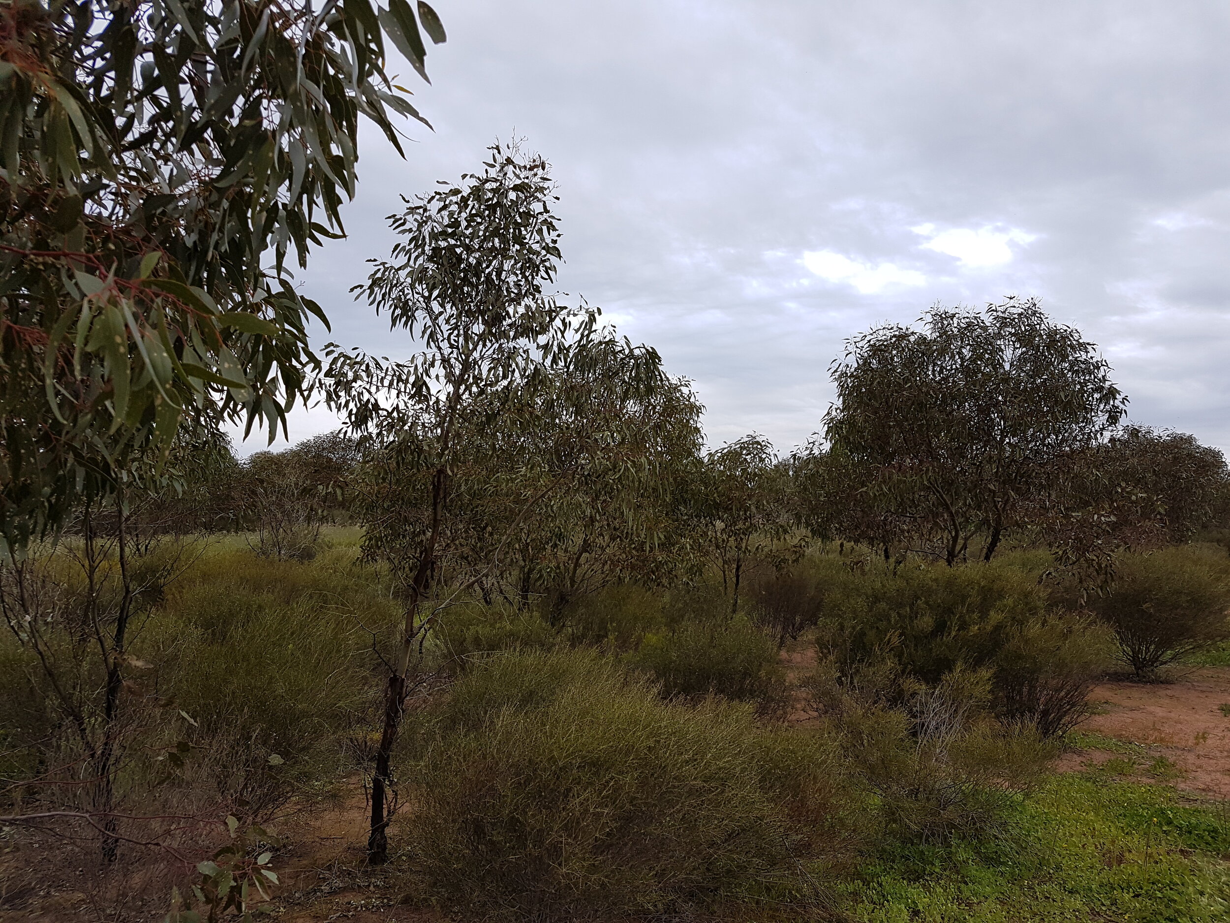
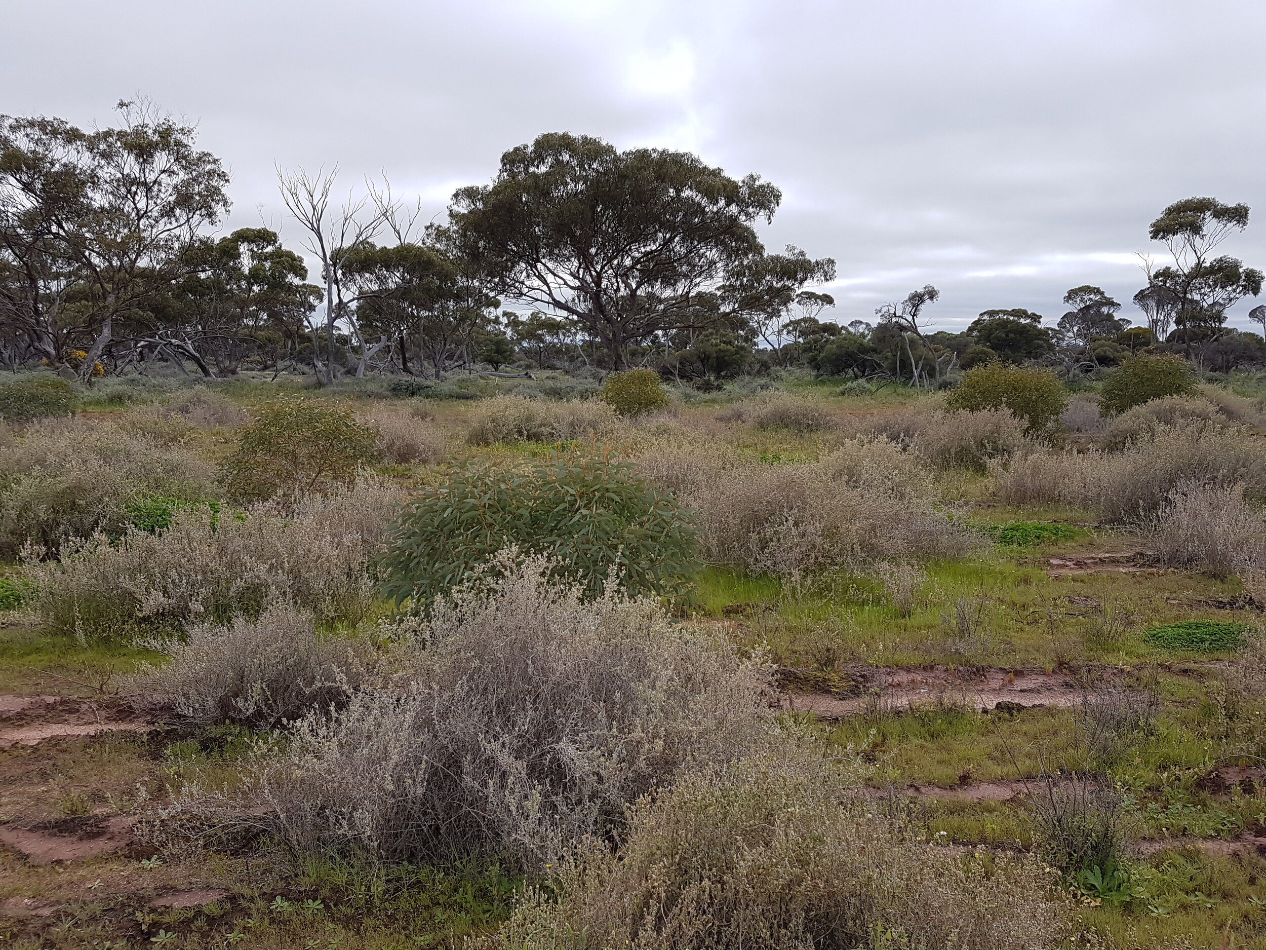
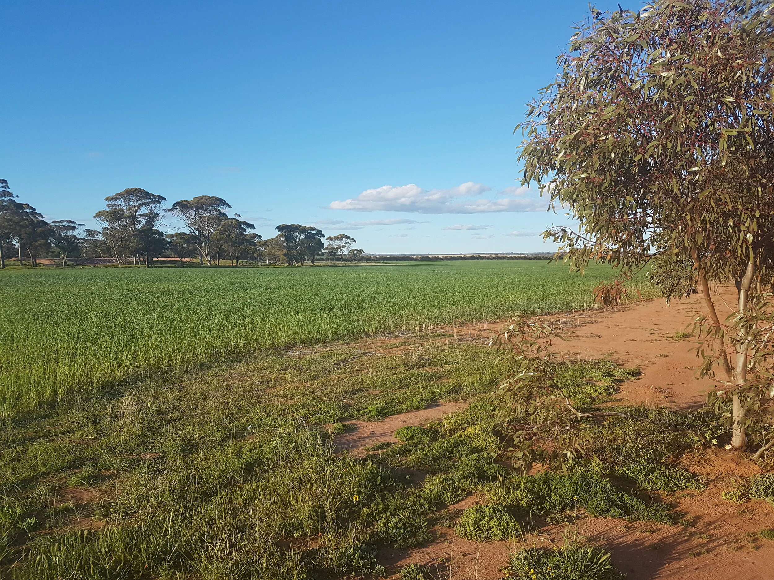
The majority of the plantings in the project are biodiverse plantings of local native species, replacing the same flora that was present prior to clearing for agriculture, with the remainder being plantings of endemic mallee species.
All of the plantings in the Western Farm Trees project are important valuable long term additions to the rich and unique natural vegetation of the Western Australian wheatbelt.
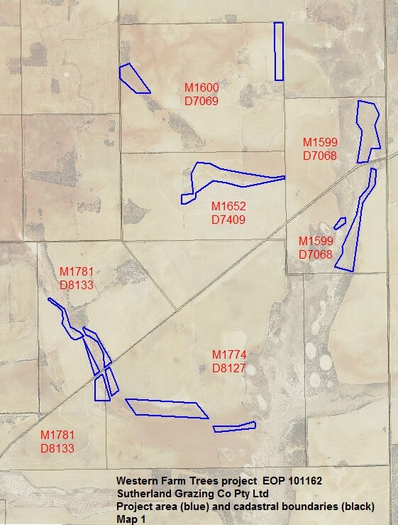
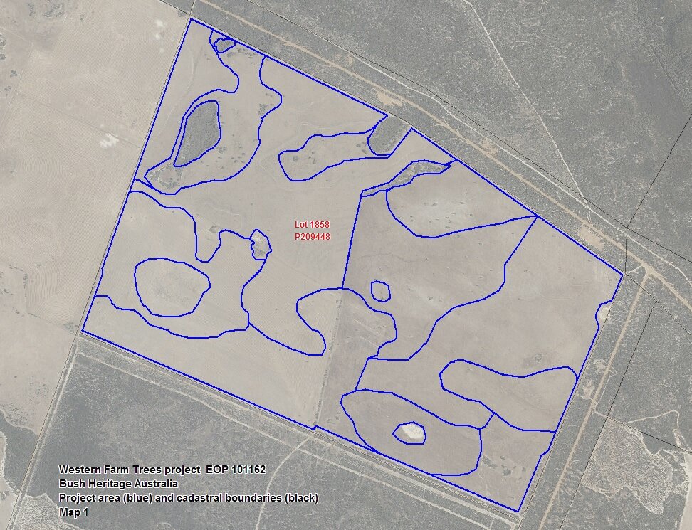
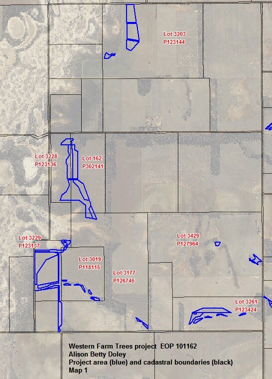
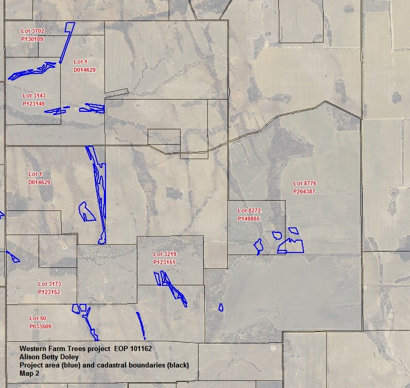
Total project area is 1669 hectares, bounded by Morawa in the north, Coorow in the west, Bencubbin in the east, and Gairdner in the south.
There are 37 individual Carbon Estimation Areas (CEAs) totaling 564 hectares.

History of the Western Australian wheatbelt
Western Australia became a State in the new Federation on 1/1/1901 but even prior to that period there had been an increase in farming activities. Many of the methods used for land clearing in the area, which is known as the Western Australian Wheatbelt, was undertaken by horse-drawn rollers in the early part of the century to tractors with drag scrub rollers. This process uprooted trees, allowing wheat to be planted.
Despite a lack of water in certain areas, farming activity continued to witness a range of innovation including rain water tank and dam construction, which increased the breadth of area that was farmed.
The increased focus on agriculture led to land, which had previously been viewed as marginal becoming an area of growth by the second half of last century. Land cleared for farming increased from 6.8 million hectares to 15 million within the first 3 decades of the latter half of the 20th century.
Wheat became the State’s major export earner, it was a vital part of the local economy for much of last century. However, the resulting effect was a reduction in overall biodiversity, a loss of plant species and an increase in salinity.
For more detailed history follow this link.
Project operations and outcomes

Landholder’s perspective
The landholder’s rationale behind all plantings varies slightly between plantings but is based on a common theme of returning areas of the highly cleared wheatbelt landscape to deep rooted woody vegetation similar to the native vegetation.
This has benefits such as:
increased water use compared to annual crops and pastures, in turn reducing the spread of groundwater and soil salinisation
providing permanent vegetation cover stabilising and protecting soils from wind and rain
providing permanent vegetation cover to encourage the return of other species such as other flora, fungi, birds and insects
augmenting existing natural reserves of biodiversity, or providing corridors through cleared farmland between existing biodiversity assets.
These corridors allow for the movement of species and genes through the landscape into the future and are widely recognised as being crucial to the long term survival of many species.
For some of the landholders, the ACCUs being generated from this project represent the culmination of years of effort to see credits generated from their own reforestation activities.
CarbonQuest Australia, commenced setting up the project, but then asked Corporate Carbon to take over the project due to CarbonQuest’s concerns about their own long term ability to undertake the project.
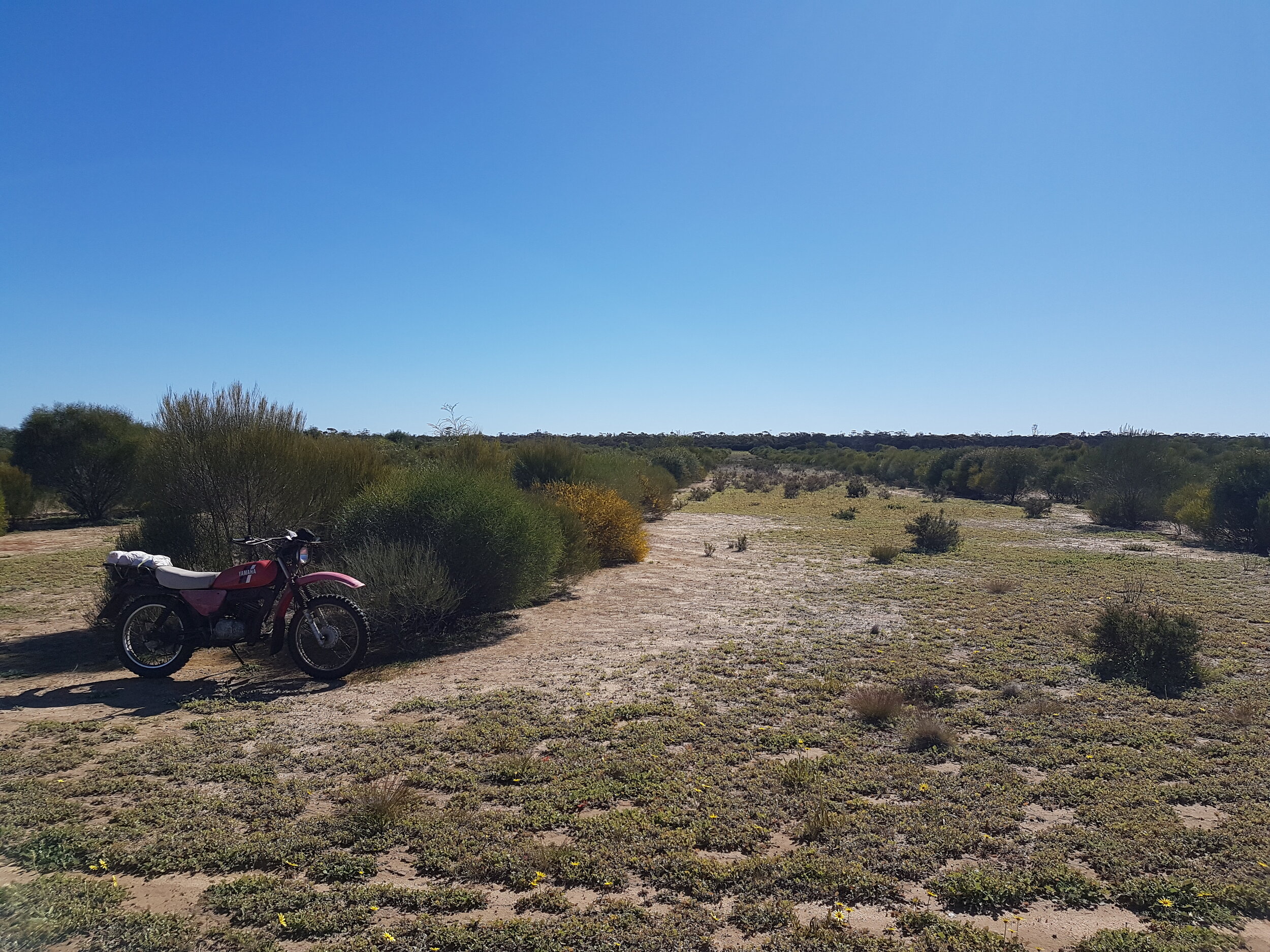
Mapping and field survey
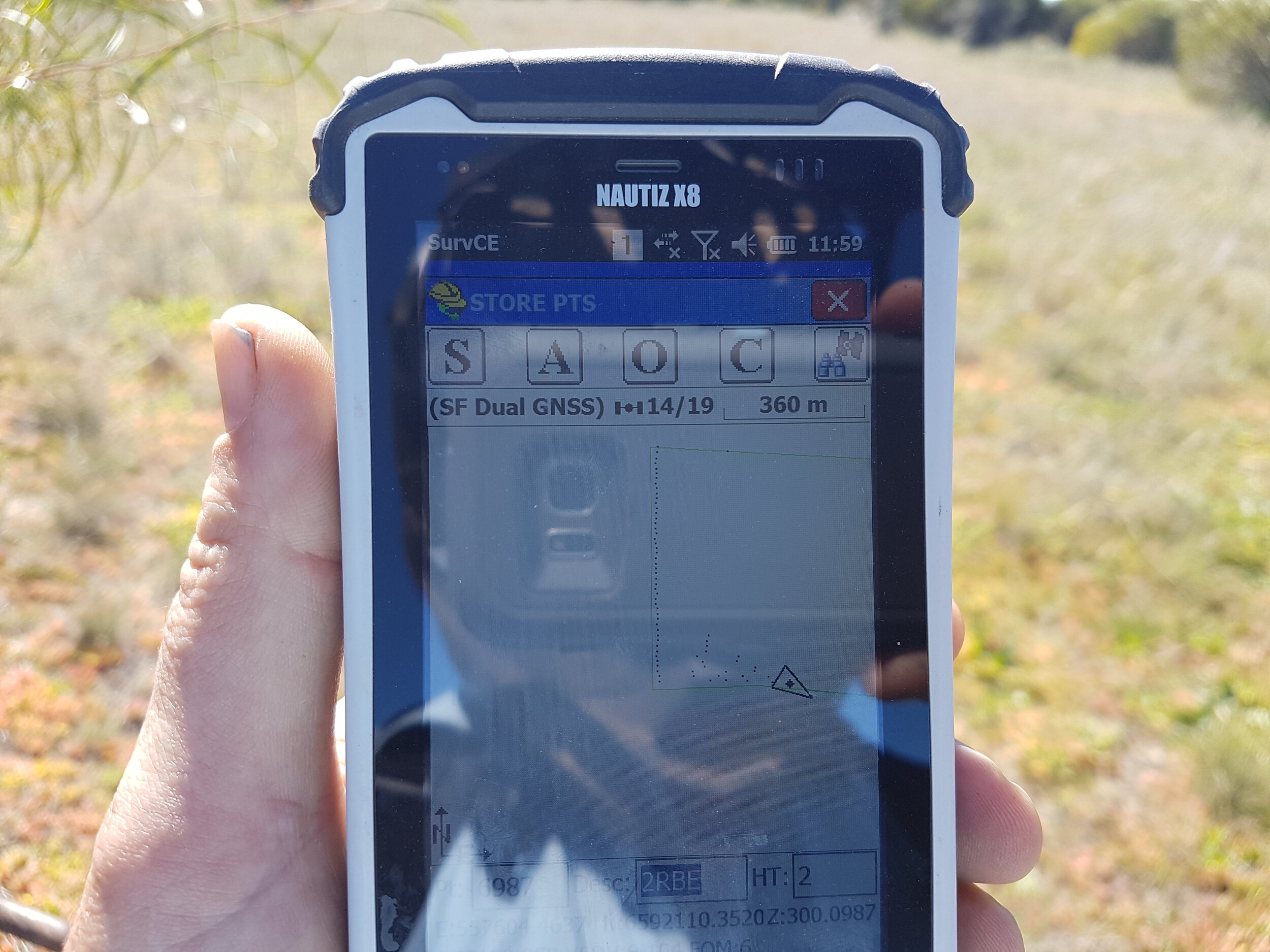
The project area was mapped at the time of project registration using the CFI Mapping Tool, on-ground GPS of corners of plantings, or landowner-supplied shapefiles.
CEAs were created through Aug and Sep 2016 through a careful process, which involved a field mapping of boundaries of surviving stems of all 6 plantings using Differential Global Positioning System (DGPS). After processing in Geographic Information System (GIS) software, resulting shapes were then further trimmed as necessary through inspection of ortho-rectified aerial imagery for any further non-compliant areas.
Buffers were added in line with the methodology and Clean Energy Regulator (CER) clarification. Resulting final polygons were grouped according to 3.3 and allocated identifying attributes to become the final CEAs for the first offset report.
Learn more about reporting for projects.
Interestingly, virtually no plantings have been found to conform to wide linear or narrow linear domain requirements, so all are treated as “block” plantings.
The exclusion area layer was created as a simple GIS-based subtraction of the CEA area from the project area.
Modelling commencement dates (i.e. the date that is entered into FullCAM) was the last day of planting in each CEA.
Find additional details on the CER’s project page for Project ID EOP101162.
Interested in technical aspects of mapping:

Forest management as per method requirements
All plantings in CEAs in at the commencement of the project have been established between 2007 and the 2015 winter planting season.
The remainder of the Project Area is designated as an Exclusion Area (1093 ha).
Evidence of forest potential - estimated stocking density
estimated to range from 400 to 3000 stems per hectare within CEAs.
Evidence of forest potential - anticipated crown cover at maturity
estimated to range from 50% to 90% of CEA area.
It is estimated that 9 of the 32 CEAs had achieved forest cover during the reporting period, as assessed for the start of the project at the field inspection in August 2016.
This is facilitated by tight mapping of CEA areas cutting out small failed areas.
Updated data imagery processes is highlighting that several areas have achieved crown cover.
As new technology is implemented accurate and timely data is becoming more available for ongoing measurement.
Note: all 21 CEAs that were estimated to have achieved forest cover as of the 3rd offset report have further evidence to show that forest cover has been maintained using data collected during stocking and tree proportion plots and routine monitoring. This highlights the accuracy of the available evidence previously collated using the visual imagery technology.
To date there have been no disturbance events on the properties that can hinder the goals of the project activities.
Grazing has not affected the potential of any areas included in the project as CEAs to achieve forest cover. The majority of area in the project have stock excluded or are of a size or species to be unaffected by grazing.
Co-benefits: technology and mapping improvements
View the wheat belt from space with this eagle eye video from the European Space Station. The vision provides a unique angle on the area that the Western Farm Trees project is operated.
The project team’s use of satellite data and advanced mapping systems (FullCAM) provides feedback, which in turn leads to improvements such as higher levels of accuracy.
The 2020 FullCAM upgrade is an example of technology improving due to feedback from users.
More defined analysis can assist the region to adapt and mitigate the effects of climate change.


Co-benefits: increased biodiversity and income diversification

A Brief Tour of Vegetation Carbon Projects
Understanding the values created from carbon projects can create more participation in the sector, which in turn can enable solutions that provide environmental and social co-benefits, among others.


Project overview: United Nations Sustainable Development Goals (UN SDGs)

Clean water and sanitation
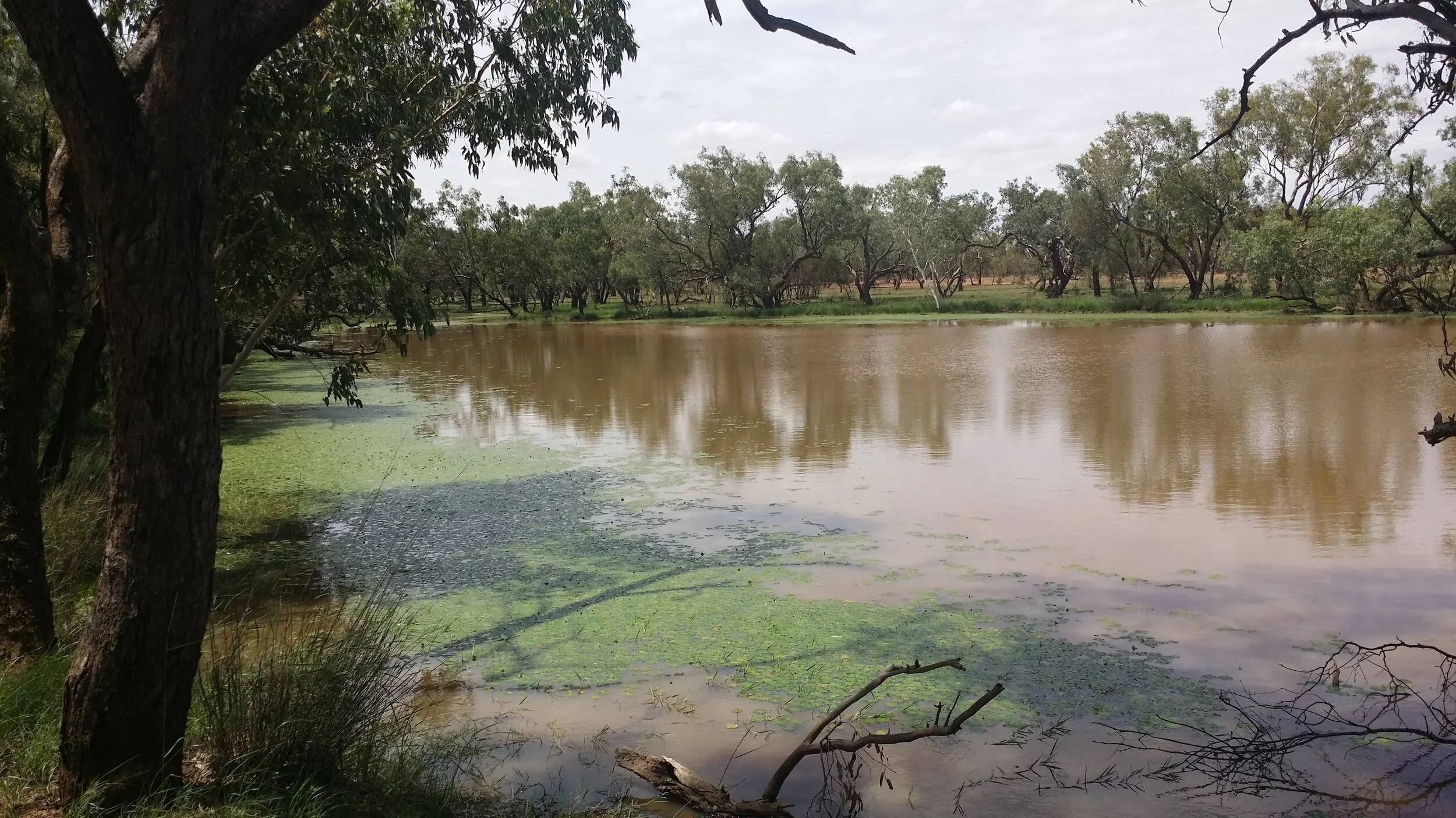
Changed agricultural practices on the property has improved ground water quality and availability due to areas showing signs of desertification being used in this carbon project. Increased vegetation in the area and a reduction of unsustainable farming operations on property has assisted in a more robust ecosystem.
The area is no longer as acutely prone to climate events as it was prior to the plantings.
The activities align with the following UN SDG targets and indicators:
Target
6.4: By 2030, substantially increase water-use efficiency across all sectors and ensure sustainable withdrawals and supply of freshwater to address water scarcity and substantially reduce the number of people suffering from water scarcity.
Indicators
6.4.1: Change in water-use efficiency over time.
6.4.2: Level of water stress: freshwater withdrawal as a proportion of available freshwater resources
Target
6.5: By 2030, implement integrated water resources management at all levels, including through transboundary cooperation as appropriate.
Indicators
6.5.1: Degree of integrated water resources management implementation (0-100).
Target
6.b: Support and strengthen the participation of local communities in improving water and sanitation management.
Indicators
6.5.1: Proportion of local administrative units with established and operational policies and procedures for participation of local communities in water and sanitation management.
Decent work and economic growth
Through the implementation of a carbon project on certain areas of the properties that are no longer able to be used/ selected to be used for agricultural use the landholders have diversified their income by improving the biodiversity on property.
This practice, in turn, decouples productivity on the property with environmental degradation.
The activities align with the following UN SDG targets and indicators:
Target
8.2: Achieve higher levels of economic productivity through diversification, technological upgrading and innovation, including through a focus on high-value added and labour-intensive sectors.
Indicators
8.2.1: Annual growth rate of real GDP per employed person.
Target
8.4: Improve progressively, through 2030, global resource efficiency in consumption and production and endeavour to decouple economic growth from environmental degradation, in accordance with the 10-year framework of programmes on sustainable consumption and production, with developed countries taking the lead.
Indicators
8.4.1: Material footprint, material footprint per capita, and material footprint per GDP.

Climate action
The project’s core focus is on achieving positive climate outcomes. Re-establishing vegetation, improving waterways and in turn increasing biodiversity has enabled the land to become more climate resilient from drought and acidification of soils.
The ambitions fall within the scope of the Australian Government’s Climate Solution Fund.
The activities align with the following UN SDG targets and indicators:
Target
13.1: Strengthen resilience and adaptive capacity to climate-related hazards and natural disasters in all countries.
Indicators
13.1.3: Proportion of local governments that adopt and implement local disaster risk reduction strategies in line with national disaster risk reduction strategies.
Target
13.2: Integrate climate change measures into national policies, strategies and planning
Indicators
13.2.1: Number of countries that have communicated the establishment or operationalisation of an integrated policy/strategy/plan which increases their ability to adapt to the adverse impacts of climate change, and foster climate resilience and low greenhouse gas emissions development in a manner that does not threaten food production (including a national adaptation plan, nationally determined contribution, national communication, biennial update report or other).

Life on land
The Western Farm Trees project focuses on sequestering carbon through environmental plantings. The project team has witnessed positive results throughout the natural ecosystem, including an improvement in biodiversity levels since the project commenced.
The changed management of agricultural equipment that has previously damaged/ suppressed native vegetation and planned plantings has allowed for the sequestration of carbon.
The activities align with the following UN SDG targets and indicators:
Target
15.1: By 2020, ensure the conservation, restoration and sustainable use of terrestrial and inland freshwater ecosystems and their services, in particular forests, wetlands, mountains and drylands, in line with obligations under international agreements.
Indicators
15.1.1: Forest area as a proportion of total land area.
15.1.2: Proportion of important sites for terrestrial and freshwater biodiversity that are covered by protected areas, by ecosystem type.
Target
15.2: By 2020, promote the implementation of sustainable management of all types of forests, halt deforestation, restore degraded forests and substantially increase afforestation and reforestation globally.
Indicators
15.2.1: Progress towards sustainable forest management.
Target
15.3: By 2030, combat desertification, restore degraded land and soil, including land affected by desertification, drought and floods, and strive to achieve a land degradation-neutral world.
Indicators
15.3.1: Proportion of land that is degraded over total land area.
Target
15.5: Take urgent and significant action to reduce the degradation of natural habitats, halt the loss of biodiversity and, by 2020, protect and prevent the extinction of threatened species.
Indicators
15.5.1: Red List Index.
Target
15.8: By 2020, introduce measures to prevent the introduction and significantly reduce the impact of invasive alien species on land and water ecosystems and control or eradicate the priority species.
Indicators
15.8.1: Proportion of countries adopting relevant national legislation and adequately resourcing the prevention or control of invasive alien species.
Target
15.9: By 2020, integrate ecosystem and biodiversity values into national and local planning, development processes, poverty reduction strategies and accounts.
Indicators
15.9.1: Progress towards national targets established in accordance with Aichi Biodiversity Target 2 of the Strategic Plan for Biodiversity 2011-2020.

Sources of demand for ACCUs
There are multiple possible sources of demand for the Australian carbon credit units (ACCUs) generated by Emissions Reduction Fund projects, including:
Voluntary markets
State and territory governments.
For more information about the sources of demand for ACCUs, see the Clean Energy Regulator’s presentation “Sourcing ACCUs in the market”.
Emissions Reduction Fund auctions
Emissions Reduction Fund participants with a registered project may bid for a contract to sell their Australian carbon credit units to the Clean Energy Regulator. The Clean Energy Regulator will run auctions to select bidders according to price.
Contract holders may also purchase ACCUs from un-contracted projects to meet contractual obligations.

Safeguard mechanism
Under the safeguard mechanism, particular facilities are required to keep their emissions at or below a baseline set by the Clean Energy Regulator.
Safeguard facilities who exceed their emissions baseline are able to surrender ACCUs to offset excess emissions.
Both Kyoto and non-Kyoto ACCUs can be used as credits under the safeguard mechanism.
Read more about the safeguard mechanism.
Other markets
Organisations may wish to voluntarily offset their emissions for meeting certification under the Climate Active Carbon Neutral Certification Standard (formerly the National Carbon Offset Standard).
State and territory governments are also seeking to be carbon neutral and may source ACCUs to offset their emissions.
Purchasing ACCUs from the Western Farm Trees project
Corporate Carbon Advisory have the rights to sell/retire ACCUs for this project. This includes the right to bid for an auction contract and to sell it as a credit on the voluntary market to assist organisations in meeting certification under Climate Active, or similar, standards.
Contact the team to learn about current availability of Western Farm Trees ACCUs.
Participating in vegetation projects
There is a unique opportunity to become involved in environmental plantings projects with Corporate Carbon.
Organisations and/ or individiuals who are involved with locations that are seeking to grow vegetation on suppressed land can join our aggregated projects to generate ACCUs as part of the Climate Solutions Fund.
If you are looking to increase the amount of trees in your area by:
Establishing and maintaining a mixed-species environmental planting, or a Mallee planting. Plantings
You may be eligible to participate.
Contact the team to learn more about this unique pathway to gain economic benefits and environmental certification.
All photographs and content have been approved for use on this webpage.